
Topographical Map of Wolfe Island
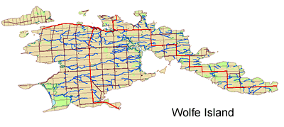
Topographical map of Wolfe Island. Prepared in Adobe Acrobat PDF format this map will print out on 2 standard 8.5 x 11 sheets of paper. It shows the road network, wetlands, areas covered by vegetation and watersheds on the island. It provides good clues to the locations of various habitat types for birdwatchers and others interested in exploring the island.
Please remember that many areas of the island are private property, please avoid crossing private land without permission from the owner.